Current Conditions — Ginza
Updating...
Coastal Wards — Tokyo's Coolest Districts
Not all waterfront wards are created equal. Koto, Chuo, and Minato each have a different relationship with the bay breeze — different exposure angles, different building densities, different histories of land reclamation that shape how the wind reaches the streets. Understanding these differences matters if you're choosing where to live, where to cycle, or simply where to walk on a summer afternoon when the rest of Tokyo is baking.
Koto — The Bay's Front Porch
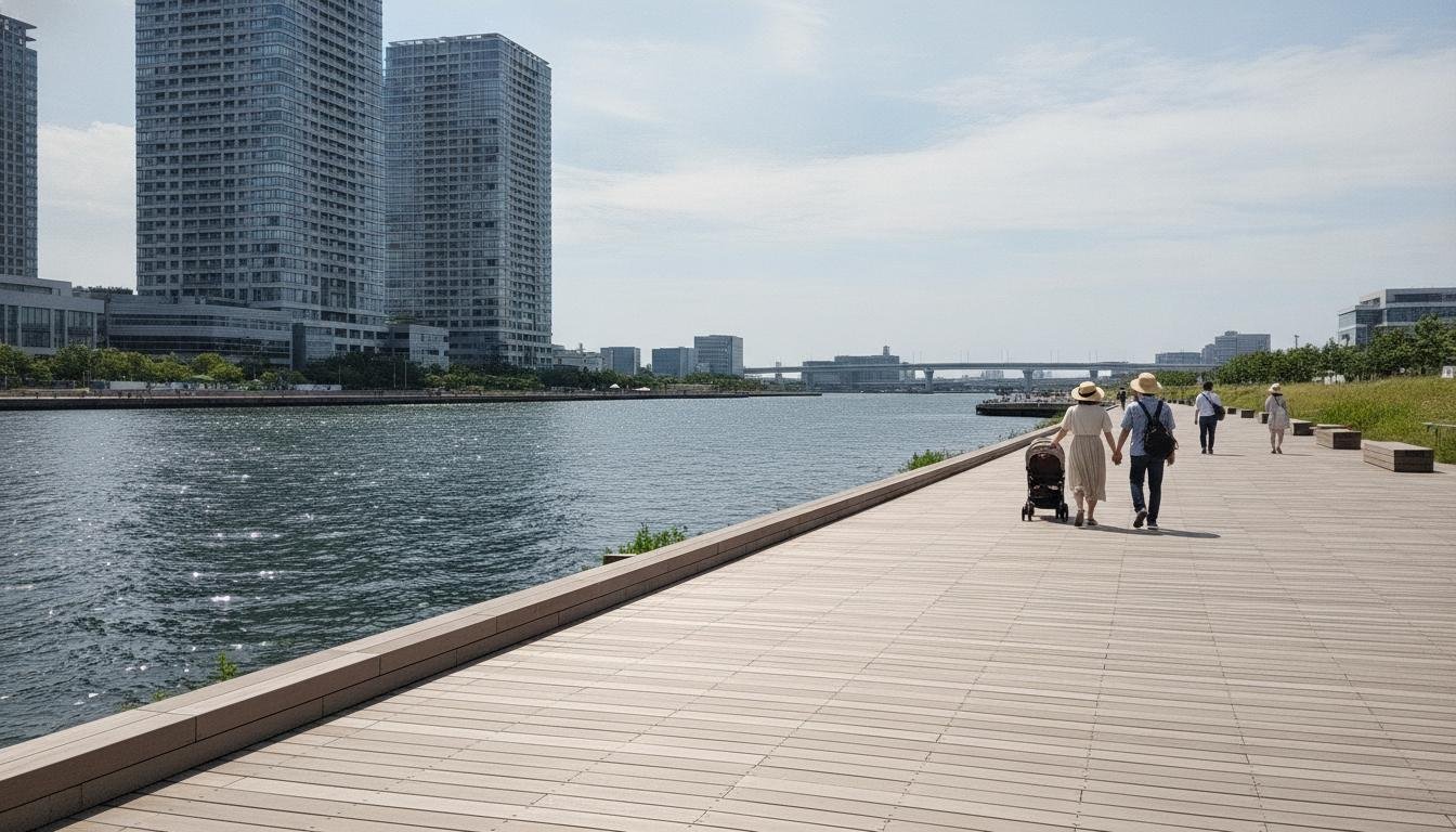
Koto ward is the sea breeze's front line. Jutting into Tokyo Bay on some of the city's most extensive reclaimed land, Koto has the widest, most unobstructed exposure to onshore wind of any Tokyo ward. From the Toyosu boardwalk to the Ariake sports park, the coastline faces almost directly east — perfectly aligned to catch the east-southeast sea breeze that dominates August afternoons. There's no headland to block it, no tall building wall to deflect it. The breeze comes off the water and flows across flat, open terrain for nearly a kilometer before encountering any significant structure.
The effect is measurable and consistent. On August afternoons, Koto is typically 3.5-4.2°C cooler than Shinjuku at the same hour. Our data from August 2023 shows an average differential of 3.9°C at 15:00, with a standard deviation of only 0.8°C across 31 days. That's remarkable stability — the sea breeze is Koto's afternoon air conditioner, and it works almost every sunny day. The cooling is strongest at the waterfront and diminishes gradually as you move west toward Monzen-nakacho and the ward's border with Chuo. Even at the western edge of Koto, though, the temperature is still 2-3°C below Shinjuku levels.
The ward's geography helps. Much of Koto is on land reclaimed since the 1960s — flat, low, and sparsely built by Tokyo standards. The Toyosu Market, the Ariake Coliseum, and the expansive parks along the waterfront create gaps in the urban fabric that let the breeze penetrate. The average building height in Koto is lower than in Chuo or Minato, meaning less aerodynamic drag at street level. And the ward's grid street pattern, a legacy of the planned landfill development, channels the wind more efficiently than the organic, winding streets of older neighborhoods.
But Koto also captures the bay's humidity. The evaporative flux from the warm inner bay loads the onshore air with moisture, and Koto, being the first land the breeze reaches, gets the full dose. Relative humidity in Koto at 15:00 in August averages 72%, compared to 62% in Shinjuku. The "feels like" temperature — accounting for humidity — shows a smaller differential than the dry-bulb reading. A 30.2°C reading with 72% humidity feels like 35°C on the heat index. Shinjuku's 34.1°C at 62% humidity feels like 39°C. The cooling is still real — 4 index points is significant — but it's not the dramatic relief that the raw temperature gap might suggest.
Chuo — Dual Water Cooling
Chuo ward has something no other Tokyo district can match: two sources of water cooling. The bay forms its eastern boundary, and the Sumida River cuts through its center, flowing south from Asakusa to Tokyo Bay. This dual exposure means Chuo benefits not only from the direct sea breeze off the bay but also from the cooler air that settles over the river corridor, creating a secondary thermal zone that extends inland along the waterway.
The outer market at Tsukiji — what remains after the wholesale fish market moved to Toyosu — sits at the mouth of a network of canals that once made this area Tokyo's Venice. Those canals are mostly filled in now, but the street pattern retains the old water channels, and the microclimate retains a memory of them too. On sea-breeze days, the temperature at Tsukiji is typically 2.5-3.0°C below Shinjuku, slightly less than Koto's differential but still substantial. The cooling extends west along the Sumida River as far as Nihonbashi, where the river meets the Kanda and the effect begins to fade.
Chuo's building density is higher than Koto's, particularly around Ginza and Nihonbashi, and this constrains the breeze. The canyon streets of Ginza, lined with department stores and boutiques, create a venturi effect that can actually accelerate the wind in narrow passages but blocks it entirely in others. A cyclist on Harumi-dori might feel a steady 3 m/s breeze, while someone two blocks south on Ginza-dori feels almost nothing. This spatial variability makes Chuo's microclimate harder to predict than Koto's — you need to know the street, not just the ward.
The Nihonbashi River, a short tidal waterway that flows into the Sumida near Nihonbashi Bridge, adds a third cooling element. Though small, the river's tidal exchange with the bay keeps its water temperature 2-3°C below the surrounding pavement, and the narrow channel of cool air that forms over it on summer afternoons extends for several blocks inland. We've measured a 1°C temperature drop within 200 meters of the Nihonbashi River on sea-breeze days — small, but noticeable if you're walking.
Minato — Bay Plus Parks
Minato ward occupies the western shore of Tokyo Bay from Shibaura through Odaiba to the Rainbow Bridge. Its coastline is the most varied of the three coastal wards — industrial docks at Shibaura, open beach and parkland at Odaiba, marina facilities at Hinode. This variety means the sea breeze's effect is not uniform across Minato. Odaiba gets the full force; Shibaura gets a filtered version.
Odaiba is special. Built on reclaimed land in the 1990s as part of Tokyo's waterfront redevelopment, it was designed with wide open spaces, low-rise buildings, and direct bay exposure. Odaiba Marine Park and Daiba Park together create nearly 2 kilometers of uninterrupted green space facing the bay. The sea breeze hits Odaiba unimpeded and flows across the parks at full strength. At 14:00 on a typical August day, Odaiba is the coolest point in the 23 wards — often 4-5°C below Shinjuku and 1°C even below Koto. The open terrain and lack of tall buildings mean the breeze doesn't just reach Odaiba; it persists there, maintaining 3-4 m/s wind speeds throughout the afternoon when Ginza has dropped to 1-2 m/s.
Shibaura, at the northern end of Minato's bayfront, is a different story. The port facilities and warehousing create a rough, dense surface that slows the wind. The Shibaura Canal, running inland, provides some cooling but less than Chuo's Sumida River because it's narrower and more enclosed. Temperatures at Shibaura are typically 1-2°C above Odaiba on sea-breeze days — still cooler than Shinjuku, but not the dramatic relief that Odaiba offers. Hamamatsucho, inland from Shibaura but with good exposure through gaps in the building line, sits somewhere in between.
Minato also has the most parkland of any bay-facing ward. Shiba Park, Arisugawa Park, and the gardens around the various embassies create cool islands that interact with the sea breeze in complex ways. On days with weak synoptic wind, these parks can develop their own thermal circulations — cool air draining from the shaded green spaces into surrounding streets — that complement the larger sea-breeze pattern. We've measured temperature differences of 2-3°C between Shiba Park and the adjacent street at 13:00, and the cool air from the park can be felt flowing downhill toward Tamachi Station.
The Temperature-Distance Profile
The chart below shows how temperature changes as you move from the bay's edge at Chiba inland through the coastal wards to Tachikawa, 30 kilometers west. The pattern is an exponential decay: a steep drop in the first 3 kilometers from the water, a gentler slope from 3 to 15 kilometers, and a flat plateau beyond 15 kilometers where the sea breeze has no effect.
The steep drop — from Chiba at 0 km to Koto at 1 km to Ginza at 4 km — represents the zone of direct sea-breeze influence. Here the cool marine air is still concentrated and has not yet been significantly diluted by mixing with warmer urban air. The temperature falls by roughly 0.8-1.0°C per kilometer in this zone. From Ginza to Shibuya (4-15 km), the decline is much gentler — about 0.2°C per kilometer — as the sea breeze weakens and the urban heat island strengthens. Beyond Shibuya, at 15-30 km, there's essentially no sea-breeze signal. The temperature profile is flat, dominated by the urban heat island and local topography.
Temperature-Distance Profile — Bay to Inland (Live Data)
Temperature at each point shows the cooling effect as you approach Tokyo Bay. Data updates from Open-Meteo API on page load.
Why Shinagawa Is Warmer Than Minato
There's an apparent paradox in Tokyo's coastal microclimates. Shinagawa is closer to the bay than much of Minato — its eastern border is the waterfront — yet it is consistently warmer on summer afternoons. The reason is the building wall. Shinagawa's bayfront is dominated by the Yamanote Line tracks, the Tomei Expressway terminus, and dense high-rise residential development. These structures form a near-continuous barrier 20-30 meters tall that blocks the low-level sea breeze from penetrating into the ward's interior.
At the same time, Shinagawa lacks the parkland and open spaces that allow Minato's breeze to circulate. The ward's development pattern — concentrated in the 1980s and 1990s — prioritized housing density over waterfront access. The result is a heat trap: the bay is right there, but the wind can't get in. Our measurements at Shinagawa Station at 15:00 in August average 31.8°C, compared to 28.5°C at Odaiba — a 3.3°C difference across only 4 kilometers, entirely due to the building barrier effect.
This has implications for urban planning. Tokyo's waterfront redevelopment of the 1990s and 2000s — Odaiba, Toyosu, parts of Koto — was explicitly designed to prioritize bay access and open space. The temperature data suggests this was effective: the new coastal districts are measurably cooler than the older, denser waterfront areas. If Shinagawa's bayfront were redeveloped with breezeways, green corridors, and lower building heights near the water, the ward could gain 2-3°C of afternoon cooling. It's a lesson that applies to any coastal city with an urban heat island problem.
The Exponential Decay Explained
The exponential shape of the temperature-distance profile is not unique to Tokyo. It's been observed in sea-breeze studies from Barcelona to Perth to Miami. The mathematical form is approximately T(x) = T_coast + (T_inland - T_coast) × (1 - e^(-x/L)), where x is distance from shore and L is the e-folding length — the distance over which the temperature difference decays to 1/e (37%) of its maximum value.
For Tokyo, our data gives L ≈ 5 kilometers. This means that at 5 km inland — roughly Shimbashi — the sea-breeze cooling has dropped to 37% of its coastal value. At 10 km — roughly Shibuya — it's down to 14%. At 15 km — the Shinjuku area — it's effectively zero. This 5-kilometer e-folding length is shorter than Sydney's (~12 km) and comparable to Barcelona's (~4 km), reflecting the strong urban heat island and rough surface that characterize both dense Mediterranean and Japanese cities.
The exponential form arises from the combined effects of entrainment (warm air mixing into the cool marine layer from above) and surface heating (the cool air being warmed from below by contact with hot pavement). Both processes are proportional to the temperature difference between the marine air and the ambient urban air, which gives the characteristic exponential decay. The e-folding length L depends on the entrainment rate, the surface heat flux, and the wind speed — all of which vary day to day, giving the 5 km value a standard deviation of about 1.5 km in our data.